|
|||
|
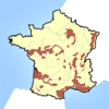
Wine Maps provides a handy visual reference to over 1300+ of the world's wine regions. Ideal for use at home, or in a restaurant, you can quickly look up which part of the world your wine came from. Wine Maps works especially well in a wine tasting, and can even provide printouts. Each map is a single click away from the main screen. Simply choose from the main wine region list, and you instantly have a map of that region. You can search for regions by name, and Wine Maps will neatly zoom into its location. Each map has the wine regions clearly presented, along with rivers, cities, and major towns. Wine maps takes a 'top down' approach, and currently individual wineries are not shown on the maps. Wine maps is a visual reference, and doesn't give descriptions of each region. Each map can be printed via Air Print by clicking on the print button in the top right corner. Maps will be printed portrait or landscape, based on your devices orientation. Printed maps can be freely distributed, making them ideal as handouts for a wine tasting. Features: * Locate one of 1300+ wine regions in seconds * 85 Maps covering 17 countries * Accessible top down approach * iPad and iPhone support * No additional costs * Works offline * Maps can be printed via Air Print Which Regions are included? Old World - 10 Countries, and 42 Regions: - Austria - Czech Republic - France (with subregions Alsace, Bordeaux, Burgundy, Beaujolais, Champagne, Corsica, Cote Chalonnaise, Cote de Beaune, Cote De Nuits, Jura, Languedoc, Loire, Macon, Provence, Rhone, Roussillon, Sauternes and Savoie), - Germany - Greece - Hungary - Italy (with subregions Abruzzo, Basilicata, Calabria, Campania, Emilia Romagna, Friuli Venezia Giulia, Lazio, Ligura, Lombardy, Marche, Molise, Piedmont, Puglia, Sardegna, Sicilia, Toscana, Trentino Alto Adige, Umbria and Veneto) - Portugal - Spain (with subregion Aragon, Catalunya, Murcia, Rioja and Navarra, Valencia) - Switzerland New World - 7 Countries, and 26 Regions: - Argentina - Australia (with subregions New South Wales, South Australia, Victoria and Western Australia), - Canada (with subregion Ontario) - Chile - New Zealand - South Africa - USA (with the subregion of California, Sonoma County, Napa County, Lake County, Mendocino County, Monterey, El Dorado, San Benito, San Luis Obispo, Santa Barbera, Sacramento, Lodi, Los Angeles, San Francisco Bay, Ventura, Michigan, New York, North Carolina, Oregon, Pennsylvania, Texas, Virginia and Washington). © © Jon Lord |
You are here: Home // レファレンス // Wine Maps – Jon Lord
Wine Maps – Jon Lord
3月 18, 2015 | コメントは受け付けていません。Tags: Reference
You are here: Home // レファレンス // Wine Maps – Jon Lord
Wine Maps – Jon Lord
3月 18, 2015 | コメントは受け付けていません。
|
|||
|
Wine Maps provides a handy visual reference to over 1300+ of the world's wine regions. Ideal for use at home, or in a restaurant, you can quickly look up which part of the world your wine came from. Wine Maps works especially well in a wine tasting, and can even provide printouts. Each map is a single click away from the main screen. Simply choose from the main wine region list, and you instantly have a map of that region. You can search for regions by name, and Wine Maps will neatly zoom into its location. Each map has the wine regions clearly presented, along with rivers, cities, and major towns. Wine maps takes a 'top down' approach, and currently individual wineries are not shown on the maps. Wine maps is a visual reference, and doesn't give descriptions of each region. Each map can be printed via Air Print by clicking on the print button in the top right corner. Maps will be printed portrait or landscape, based on your devices orientation. Printed maps can be freely distributed, making them ideal as handouts for a wine tasting. Features: * Locate one of 1300+ wine regions in seconds * 85 Maps covering 17 countries * Accessible top down approach * iPad and iPhone support * No additional costs * Works offline * Maps can be printed via Air Print Which Regions are included? Old World - 10 Countries, and 42 Regions: - Austria - Czech Republic - France (with subregions Alsace, Bordeaux, Burgundy, Beaujolais, Champagne, Corsica, Cote Chalonnaise, Cote de Beaune, Cote De Nuits, Jura, Languedoc, Loire, Macon, Provence, Rhone, Roussillon, Sauternes and Savoie), - Germany - Greece - Hungary - Italy (with subregions Abruzzo, Basilicata, Calabria, Campania, Emilia Romagna, Friuli Venezia Giulia, Lazio, Ligura, Lombardy, Marche, Molise, Piedmont, Puglia, Sardegna, Sicilia, Toscana, Trentino Alto Adige, Umbria and Veneto) - Portugal - Spain (with subregion Aragon, Catalunya, Murcia, Rioja and Navarra, Valencia) - Switzerland New World - 7 Countries, and 26 Regions: - Argentina - Australia (with subregions New South Wales, South Australia, Victoria and Western Australia), - Canada (with subregion Ontario) - Chile - New Zealand - South Africa - USA (with the subregion of California, Sonoma County, Napa County, Lake County, Mendocino County, Monterey, El Dorado, San Benito, San Luis Obispo, Santa Barbera, Sacramento, Lodi, Los Angeles, San Francisco Bay, Ventura, Michigan, New York, North Carolina, Oregon, Pennsylvania, Texas, Virginia and Washington). © © Jon Lord |
Tags: Reference
