|
|||
|
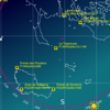
Prepare your navigation and your landings : includes GSHHS shore lines, major lighthouses, GPS, AIS, magnetic variation, position of Sun and Moon, logbook. ------- Version 1.4 includes : Fixes ios7 and iPhone 5 display issues Adds COG and SOG ------- Version 1.3 includes : Also embedded are the USCG database and NGA database of all marine lights around the world, that have a nominal range of 10 or more Nautical Miles. IMPORTANTE NOTICE : Mariners should consult all sources of information they have before engaging their vessel to an unkwnow area, in particular notices to mariners. NOTICE : NGA and USCG lights databases have been extracted in Feb 2013. This application will be updated in a regular basis. ------- Version 1.2 includes : All major ligthhouses (landing) that have a distance at least 15 NM for the following countries : US east coasts (thanks to NOAA S-57 data) and Cuba, France Atlantic and Mediteranean coast, Corse, Portugal includiong Gibraltar, North Atlantic Islands (Acores, Canarias, Madera), Caraibans, Panama (Atlantic and Pacific Coasts), Colombia to French Guiana South Pacific Islands (thanks to msi.nga.mil-List of Lights) Work is in progress for a world coverage : updates are of course free for you ! iOS5 and iOS6 compatible -------- - based on the NOAA's GSHHS Shoreline Database Version 2.2.0 - world coverage from 75°S to 75°N (poles excluded) - zoom in and zoom out : automatically selects between the 5 GSHHS databases : full, high, intermediate, low, crude - mercator projection - Precise positioning of your boat and other vessels (NMEA GPS and AIS frames) - you need a NMEA Wifi connection (TCP or UDP) with a NMEA repeater like Digital Yacht's iAIS - log book (date,time,latitude,longitude,COG,SOG,Heading,Log,Water Depth, TWA,TWS,Leeway,Stream Set, Stream Drift and your comments - log book organized in passages - log book export via email (csv format) - NMEA protocol debug window - magnetic variation computed with the algorithms from the NOAA's World Magnetic Model - distance to coast - distance to others vessels - 'goto boat' function - double tap for full screen display - integrated solar compass : the rose displays the sun and moon positions in real time - made for iPad 1, 2 & iPad Retina : reveal the real beauty of the shore line - works very well too on iPhone 3, 4 and iPod 3, 4 © © iMariner Software |
You are here: Home // ナビゲーション // iMariner Offshore – DFR Editions
iMariner Offshore – DFR Editions
1月 31, 2016 | コメントは受け付けていません。Tags: Navigation
