|
|||
|
The ONLY app to show live traffic incidents, roadworks and over 3,000 cameras covering England, Scotland, Wales and London. The December 2017 release optimises for iOS11 and the iPhone X. KEY FEATURES Live traffic incidents, roadworks and traffic cams covering: - England: Highways Agency for all motorways and main trunk roads, 2,029 cameras - Scotland: Traffic Scotland, 274 cameras - Wales: Traffic Wales, 197 cameras - London: TfL, 918 cameras - Tyne & Wear: 125 cameras - Today screen widget to show at a glance the nearest current traffic incidents - Optimised for all iPhone and iPad models; fully tested on iOS9, iOS11 and iOS11. LIST VIEW - Shows current incidents in order of distance from your current location (closest incidents are shown first). - Each incident is colour-coded to indicate the severity of the delay. - You can quickly see the distance the incident is from you, the road name, the type of incident and when the incident info was updated. - The detail view for each incident shows the description of the incident together with a map showing the exact location of the incident. MAP VIEW - Shows current incidents and traffic cams. - Each incident is colour coded as well as being represented by an icon showing the incident type. - Clicking on an incident displays more detail right there on the map. - The map view can also show live traffic camera images. TRAFFIC CAMS - Toggle show/hide the cameras on the map. - Touch a camera icon on the map to view a live camera image. TRAFFIC CAM FAVOURITES - Save your favourite cameras for quick access to see how clear/congested your usual routes are. TODAY WIDGET - Shows at a glance the nearest current traffic incidents without launching the app. PERSONALISE - Toggle traffic information on the map. - You can configure which incidents are displayed according to the severity of the delay caused. - Miles or KM setting. ICONS AND COLOUR CODING - The icons on the map show the type of incident so you can see at a glance both the incident type and severity (indicated by the colour of the icon). The incident icons currently available are: - Accident: ambulance icon - Congestion: standard congestion sign (3 cars) icon - Breakdown: car with bonnet raised icon - Signal Failure: traffic signal icon - Event (such as football match, concert): a calendar event icon - Snow or flooding: the appropriate icon - Other/Hazard/Incident: standard hazard (exclamation mark) icon Incidents are colour coded accruing to severity: - Red: severe; delays of one hour or more, or road/exit closed - Orange: medium; delays 15 minutes or more - Green: minor; delays less than 15 minutes CONTACT - Email me for feature requests/bug reports etc. I would love to hear from you! - Follow @ukroadsapp on Twitter for latest news on the app. © © Coderun Technologies Ltd |
You are here: Home // 旅行 // UK Roads – Traffic & Cameras – Coderun Technologies Ltd
UK Roads – Traffic & Cameras – Coderun Technologies Ltd
10月 27, 2018 | コメントは受け付けていません。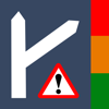
Tags: Travel